Help us map our city’s biome! Use this form to submit photos of interesting sites you see. This could be a great nature-based solution, a problem area, or a space with untapped potential. Thank you for contributing..
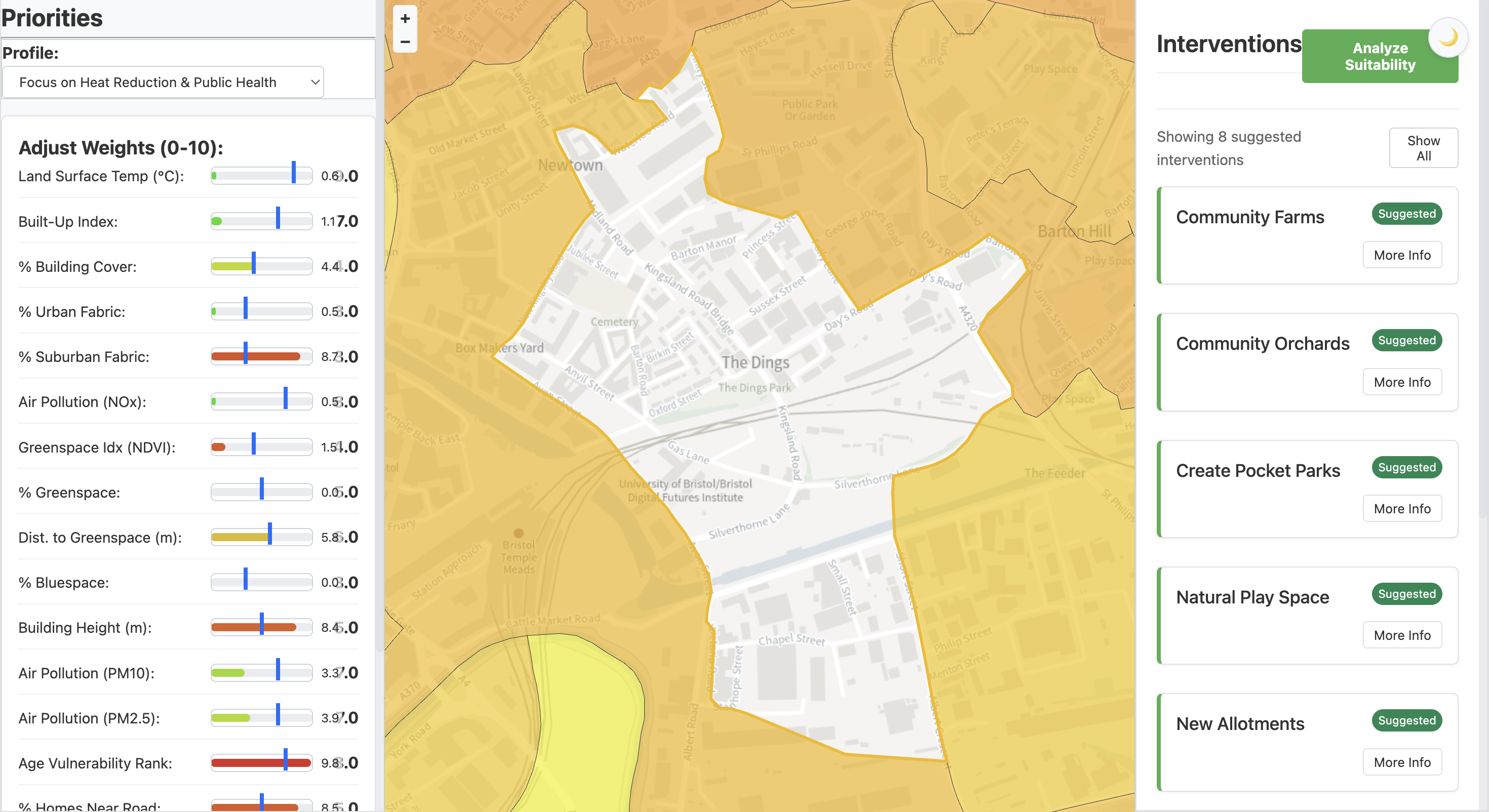
The UrbanBiome Tool in action.
Please note: Access to the UrbanBiome Tool requires authentication. Please contact us to request access.
This interactive map shows live Sentinel-2 satellite data, processed by Google Earth Engine to visualise the Normalised Difference Vegetation Index (NDVI). It is a powerful example of how we can identify areas that lack green space and target interventions where they are most needed.
Access the datasets powering UrbanBiome. Detailed information about available datasets, data standards, and licensing.
Download Raw Data (Placeholder)Integrate UrbanBiome data programmatically. Developer documentation for API endpoints, authentication, and rate limits.
View API Docs (Placeholder)For those who want to dive deeper, our wiki is an open repository of our knowledge. It contains detailed methodologies, data dictionaries, in-depth case studies, and tutorials on how to use our open data.
Please note: You are navigating to our separate documentation site.
Explore the WikiDiscover practical ways UrbanBiome is making a difference, from community gardens to innovative green infrastructure and DIY guides.
We strive to improve the environment in cities by integrating elements of nature, applying permaculture thinking, and leveraging data to create sustainable, resilient urban ecosystems.
Fostering biodiversity and restoring natural processes in urban settings.
Collaborating with local communities to create shared green spaces.
Implementing long-lasting, low-impact solutions inspired by permaculture.
Utilizing Open GIS data to identify and prioritize areas for ecological improvement.